Furlongs, Crofts and Cinder Hills: The Field Names Cowling Hasn’t Quite Forgotten
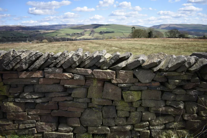
Ask someone in Cowling what a field was called and you may get a puzzled look. Ask their grandmother, or the farmer who has worked the same bit of land for forty years, and the answer can come without hesitation: ‘That’s Long Croft.’ ‘Up in the Ing.’ ‘The Cinder Hill field.’ These are not the names of farms or lanes. They are the names of the fields themselves — working labels that once divided the township into strips, crofts, closes and meadows.
Many of those names have slipped off the modern map. They survive in deeds, in tithe schedules, in enclosure awards and, crucially, in the memories of people who still think of a particular field by a name that appears nowhere official. This is part detective story and part appeal: can we piece together a lost field-name map of Cowling, and can readers help fill in the gaps?
Start with the schedule, not the map
The obvious place to begin is the tithe map. After the Tithe Commutation Act of 1836, parishes across England and Wales were surveyed so that tithes — originally payments in kind to the church — could be converted into money payments. The resulting maps are beautiful, but the real gold is the apportionment schedule that goes with them. Each field has a number on the map, and the schedule gives the owner, the occupier, the acreage, the state of cultivation and, in a column headed ‘Name and Description of Lands’, the field name itself.
Enclosure awards do a similar job for earlier reorganisations of the landscape. They list allotments, boundaries, roads and parcels, often with names that had been in use for generations. Put a tithe schedule beside an enclosure award, then lay both over a later Ordnance Survey map, and patterns start to emerge. A ‘Great Ing’ and a ‘Little Ing’ may sit next to each other. A ‘Barn Field’ may be the field beside the old barn. A ‘Pinfold Field’ may remember a place where stray beasts were once penned.
Some names are plain and practical: Chapel Field, Well Field, Kiln Close, Stack Garth. Others are older than the surveyor’s ink. ‘Ing’ often points to a meadow, sometimes one beside water. ‘Royd’ suggests a clearing. ‘Sike’ is a small stream. ‘Carr’ is wet ground, often scrubby or wooded. ‘Croft’ is a small enclosed piece, frequently close to the house. None of these words are unique to Cowling, but together they form a dialect of the landscape — a vocabulary that generations of local people used without needing to explain it.
What the names can tell us
Field names are not just poetic leftovers. They record crops and stock: Oat Croft, Pease Field, Wheat Close, Cow Pasture. They record people: Dawson’s Close, Wainman’s Field, Hodgson’s Ing. They record shape and position: Long Strip, Half Moon, Far Field, Near Close, Top o’ th’ Bank. They record wildlife and weather: Crow Nest, Fox Covert, Rookery, Fog Field, Wetlands. They can even record a joke or a grumble, though those are the hardest to prove. A field called ‘Pity Me’ or ‘Labour-in-Vain’ suggests someone once found the ground hard going.
Line enough of them up and you get more than a list of quaint names. You get a working map of how families rotated crops, grazed beasts, cut hay and quarrelled over drains. Cowling’s landscape of small stone-walled fields was never random. The names show how people thought about the land: which pieces were good for corn, which were wet, which were close enough to the house for a cow, which were only fit for rough grazing. The surveyor wrote the names down, but the names themselves were made by people who walked the ground.
The names that survive in living memory
Official records are only half the story. The most valuable field names are the ones people still use. A farmer might say ‘I’ll be up in the Ing’ without ever consulting a map. A family might refer to ‘the Cinder Hill field’ because that is what their grandfather called it. These names are passed down orally, and they do not always match the tithe map. That is fine. Field names were never fixed. A name could move from one field to the next, or stick to a gate, a barn or a track long after the field itself had been divided.
This is where local memory becomes an archive. If you remember a field name from childhood, or from a parent or grandparent, it is evidence. It may not be written down anywhere else. It may be the only surviving record of how a particular corner of Cowling was understood by the people who worked it.
Help us build a field-name memory map
We want to build a growing memory map of Cowling’s field names — past and present. We are not looking for a definitive, finished list. We are looking for fragments: names remembered, names guessed, names half-forgotten.
If you can help, send us the field name, where it was (the farm, lane or nearest landmark), what it meant or what was grown there, and whether it is still used today. A photograph of an old map, a deed or a field is welcome, but not essential. Use the contact form at cowlinghistory.co.uk with ‘Field Names’ in the subject line. We will add contributions to the map, credit contributors and cross-check them against tithe and enclosure records where we can.
No name is too ordinary. ‘Top Field’ is evidence too. We would especially like to hear names from Ickornshaw, Lane Bottom, Cowling Hill and the outlying farms, where field names often survived longer than they did closer to the village centre.
A map made of words
Field names are a kind of village memory. Some are lost. Some are sleeping in a schedule. Some are still spoken every day by people who would not dream of calling them ‘heritage’. As we work on this in 2026, the tithe map is a starting point, not a verdict. The real archive is in the kit bag, the farmhouse kitchen and the stories people tell about the land.
If you have ever said ‘down in the Carr’ or ‘up by the Cinder Hill’, you already know a piece of Cowling’s lost map. Tell us, and we will write it down.